Making Better Maps of Urban Trees in California
About the Project
The world is urbanizing and trees make urban spaces more livable. We have the largest database of urban trees in California consisting of 5.7 million individual trees. Our goal for this project is to use high resolution remote sensing and computer vision to make better maps of urban trees and to predict tree locations where no data currently exists. We want to use LiDAR imaging data to train convolutional neural networks to attempt to predict where urban tree cover exists in cities. We want to be able to predict where trees are where no inventory currently exists. Furthermore, we want to test various hypotheses about the connections and benefits of urban tree cover on human health and wellbeing.
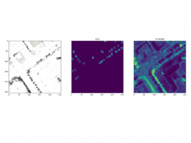
The goal of the neural network is to locate and count the trees in a 256x256 raster image. It outputs a density map using gaussian blur to smooth our predictions. On the left is the normalized input image, the middle is the ground truth, and on the right is the output of the network.
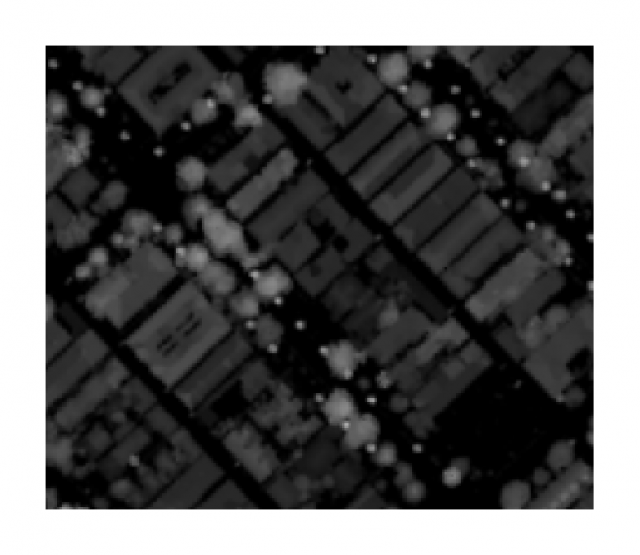
We are using CHMs in combination with RGB-Ir images to better detect trees with the CNN.
Student Team
- Joshua Abel
- Julian Davis
- Jack Langston
- Arman Rafian
Mentors
- Dr. Andrew Fricker, Faculty
- Dr. Jackie Doremus, Faculty
- Dr. Jenn Yost, Faculty
- Dr. Matt Ritter, Faculty
- Dr. Jonathan Ventura, Faculty
About the Sponsor
The men and women of the California Department of Forestry and Fire Protection (CAL FIRE) are dedicated to the fire protection and stewardship of over 31 million acres of California's privately-owned wildlands. In addition, the Department provides varied emergency services in 36 of the State's 58 counties via contracts with local governments.
Read more at https://www.fire.ca.gov/about-us/: